Map reading basics (Spatial Reasoning)
Watch this topic in 60 seconds
Free preview · Lesson 1
Understanding Map reading basics (Spatial Reasoning)
Adventures with Maps: Your First Steps in Map Reading!
Imagine you're going on a treasure hunt! How do you know where to go? You use a map, of course! Maps are like secret codes that help us understand places. They show us where things are, how to get from one place to another, and what the world looks like from high up, like a bird flying in the sky.
What is a Map?
A map is a drawing of a real place, like your school, your neighborhood, or even the whole world! But it's not just a random drawing. Maps are special because they show us things in their correct positions, just like they are in real life. Think of it like a shrinking machine that makes big places small enough to fit on a piece of paper or a screen. All the important things – houses, roads, parks, rivers – are still there, just smaller.
Why Do We Use Maps?
Maps are super useful! They help us:
- Find our way: If you're going to a new friend's house, a map can show you the best route.
- Understand places: Maps show us where different countries, states, or cities are. They help us learn about geography!
- Plan trips: Want to go on vacation? A map can help you see where you want to go and how to get there.
- See things from above: Maps give us a bird's-eye view, so we can see how everything is connected.
Looking at Maps: The Big Picture
When you look at a map, it's like looking down from an airplane. Everything is spread out, and you can see how things relate to each other. For example, you can see how a road goes past a park and then leads to a school. This is called spatial reasoning – understanding how things are arranged in space.
Think of your bedroom. If you imagine looking down from the ceiling, you can see your bed, your desk, and your closet. You know where they are in relation to each other. A map does the same thing for bigger places!
Symbols: The Secret Language of Maps
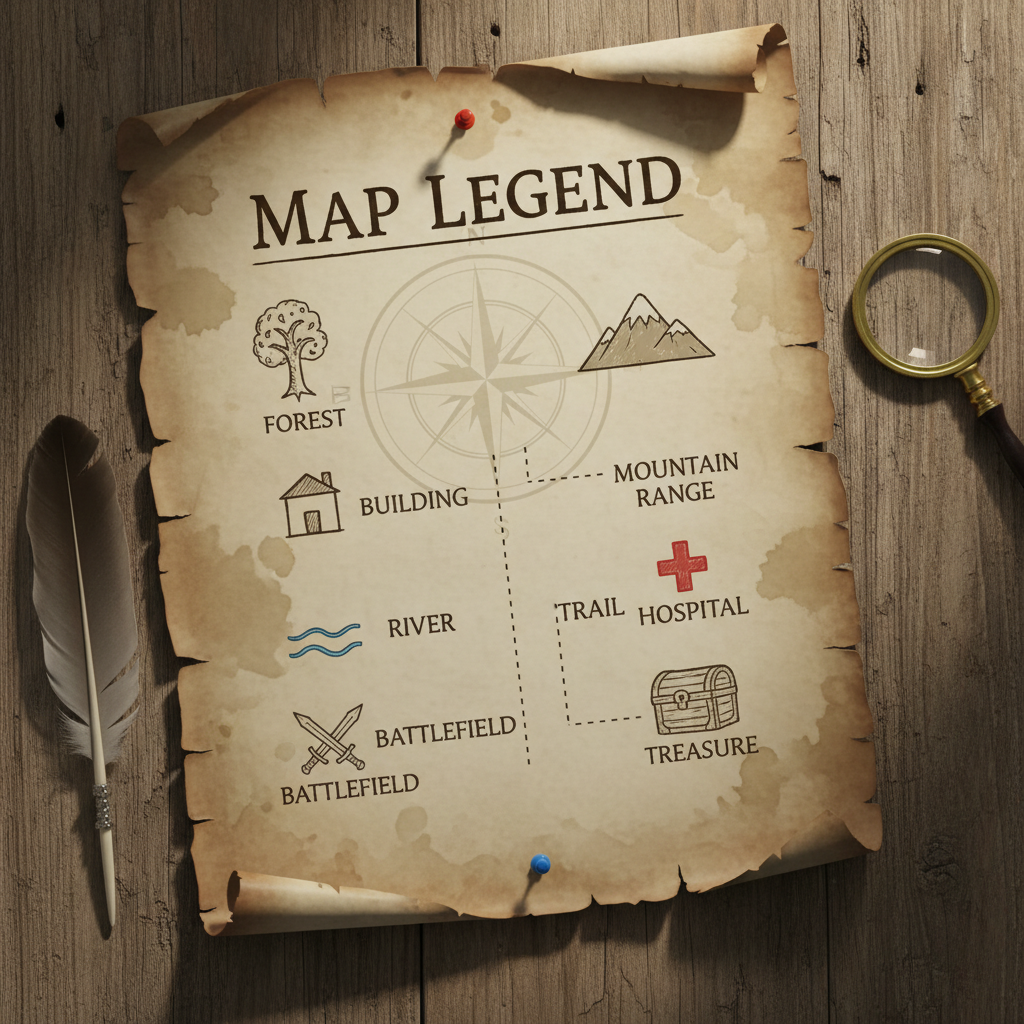
Maps use special pictures called symbols to represent things. It would be too hard to draw every single house or tree! So, maps use little pictures to stand for them. For example:
- A little blue line might mean a river.
- A small drawing of a bed might mean a hotel.
- A red circle with a star inside could mean a special landmark, like a famous statue.
To understand what these symbols mean, maps have a key or legend. The key is like a decoder ring that tells you what each symbol stands for. It's usually found in a corner of the map.
Imagine you're playing a game where 'X' means 'jump' and 'O' means 'stay put'. The key tells you what the 'X' and 'O' mean in the game. A map key does the same for the symbols on the map!
Directions: Finding Your Way Around
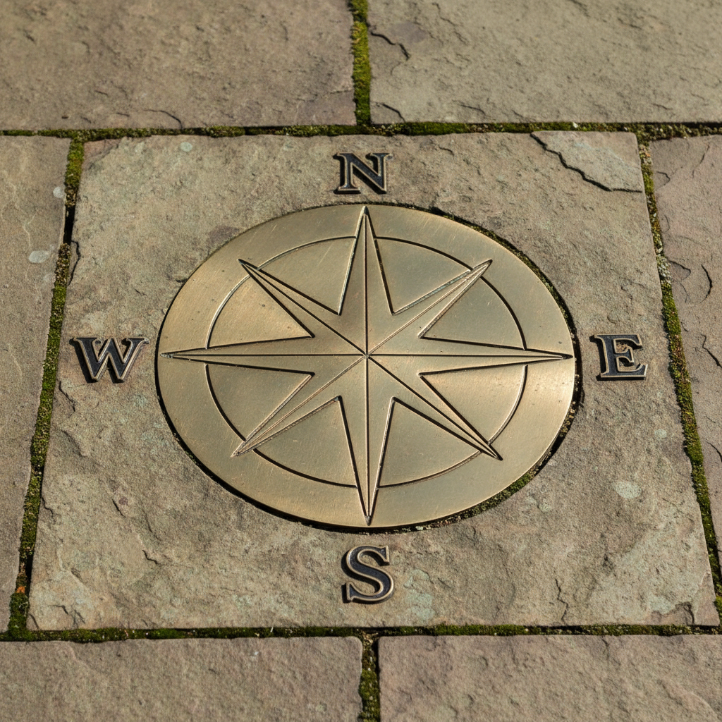
To help you understand where things are on a map, we often use directions. The most important direction is North. Think of North as the top of most maps. If you know where North is, you can figure out the other directions:
- North (N): Usually pointing up on a map.
- South (S): The opposite of North, pointing down.
- East (E): To the right of North.
- West (W): To the left of North, the opposite of East.
These four directions – North, South, East, and West – are called the cardinal directions. Sometimes, maps have a special arrow that shows you which way is North. This is called a compass rose. It looks like a star with points showing all the directions!
Think of a compass rose like the instructions for finding treasure. It tells you to go 'three steps North, then two steps East'.
Putting It All Together: Reading a Simple Map
Let's practice! Imagine a simple map of a park:
- There's a playground symbol (maybe swings and a slide).
- There's a pond symbol (a blue wavy area).
- There's a path symbol (a dotted line).
- There's a bench symbol.
The key tells you what each symbol means. The compass rose tells you that the top of the map is North.
Now, you can ask questions like:
- Where is the playground located in relation to the pond? (Is it North, South, East, or West of the pond?)
- Which way do you walk from the bench to get to the playground?
By looking at the symbols, the key, and the directions, you can understand where everything is and how to move around. This is the beginning of becoming a great map reader!
Key Concepts to Remember:
- Map: A drawing of a real place, showing things from above.
- Symbols: Pictures on a map that stand for real things.
- Key/Legend: Explains what the symbols on a map mean.
- Cardinal Directions: North, South, East, West – used to find your way.
- Compass Rose: A symbol on a map that shows directions.
- Spatial Reasoning: Understanding how things are arranged in space.
Keep learning, free
Create a free Syllabax account to unlock practice questions and games for this topic.
Visual Learning Enhanced! 🚀
To help you master this topic, we use Advanced Syllabax AI to generate detailed diagrams and visual models.
Note on Visuals: The AI sometimes makes spelling errors in image labels. Please refer to the lesson text for the correct terminology.